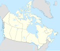
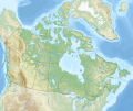
File original (File SVG, dimensiones nominal: 1 114 × 942 pixels, grandor del file: 365 KB)
Iste file proveni de Wikimedia Commons e pote esser usate per altere projectos.
Le description de su pagina de description ibi es monstrate in basso.
Summario Map Info
Properties
Projection:
Lambert conformal conic
Datum:
WGS84
Central Meridian:
95.000000°W
Latitude of Origin:
60.000000°N
Standard Parallel #1:
49.000000°N
Standard Parallel #2:
77.000000°N
Mathematics (conversion from latitude and longitude to image coordinate)
x (%)=
201.7818903*(((tan(pi*(90-$1)/360))*(((1+0.08181919084*sin(pi*$1/180))/(1-0.08181919084*sin(pi*$1/180)))^0.04090959542))^0.9007900864)*sin(0.01572175288*($2+95))+43.98563734
y (%)=
238.6252927*(((tan(pi*(90-$1)/360))*(((1+0.08181919084*sin(pi*$1/180))/(1-0.08181919084*sin(pi*$1/180)))^0.04090959542))^0.9007900864)*cos(0.01572175288*($2+95))-15.81495465
$1:
latitude in degrees (positive for all locations in Canada).
$2:
longitude in degrees (negative for all locations in Canada).
x (%):
x coordinate expressed as percentage of image width (measured from left edge).
y (%):
y coordinate expressed as percentage of image height (measured from top edge).
POIs
x (px)
y (px)
x (%)
y (%)
Latitude
Longitude
Top Left Corner:
0.000
0.000
0.00
0.00
68.220310°N
176.138684°W
Top Right Corner:
1114.000
0.000
100.00
0.00
62.238635°N
9.994317°W
Bottom Right Corner:
1114.000
942.000
100.00
100.00
34.831244°N
61.953430°W
Bottom Left Corner:
0.000
942.000
0.00
100.00
37.392537°N
121.850536°W
Centre:
557.000
471.000
50.00
50.00
63.068962°N
88.152750°W
Origin:
490.000
541.000
43.99
57.43
60.000000°N
95.000000°W
North Pole:
490.000
-148.977
43.99
-15.81
90.000000°N
⸻
Thechàl Dhâl:
67.523
368.241
6.06
39.09
61.022873°N
138.564925°W
Licentia Io, titular del derecto de autor sur iste obra, declara de publicar lo sub le sequente licentia:
Tu es libere:
de condivider – de copiar, distribuer e transmitter le obrade remixar – de adaptar le obra
Sub le sequente conditiones:
attribution – Tu debe dar information appropriate sur le autor, fornir un ligamine al licentia, e indicar si modificationes ha essite apportate. Tu pote facer lo de qualcunque maniera rationabile, ma non in alcun modo que suggere que le licentiator approba te o tu uso del obra.condivider equalmente – Si tu altera, transforma o disveloppa le material, tu debe distribuer tu contributiones sub un licentia identic o compatibile con le original. https://creativecommons.org/licenses/by-sa/4.0 CC BY-SA 4.0 Creative Commons Attribution-Share Alike 4.0 true true interlingua Adde un explanation de un linea de lo que iste file representa
francese carte politique du Canada
francese cajun Location map of Canada
Historia del file
Uso de iste file
Le sequente pagina usa iste file:
Uso global de iste file
Le altere wikis sequente usa iste imagine:
Uso in af.wikipedia.org
Uso in azb.wikipedia.org
Uso in ban.wikipedia.org
Uso in ca.wikipedia.org
Uso in en.wikipedia.org
Vider altere usos global de iste file.
Iste file contine informationes additional, probabilemente addite per le camera digital o scanner usate pro crear o digitalisar lo.
Si le file ha essite modificate ab su stato original, es possibile que alcun detalios non reflecte completemente le file modificate.


