File:Europe laea location map.svg

Dimension de iste previsualisation PNG de iste file SVG: 701 × 599 pixels. Altere resolutiones: 281 × 240 pixels | 561 × 480 pixels | 898 × 768 pixels | 1 198 × 1 024 pixels | 2 395 × 2 048 pixels | 1 401 × 1 198 pixels.
File original (File SVG, dimensiones nominal: 1 401 × 1 198 pixels, grandor del file: 2,21 MB)
Summario
| Description |
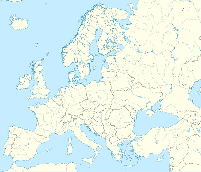
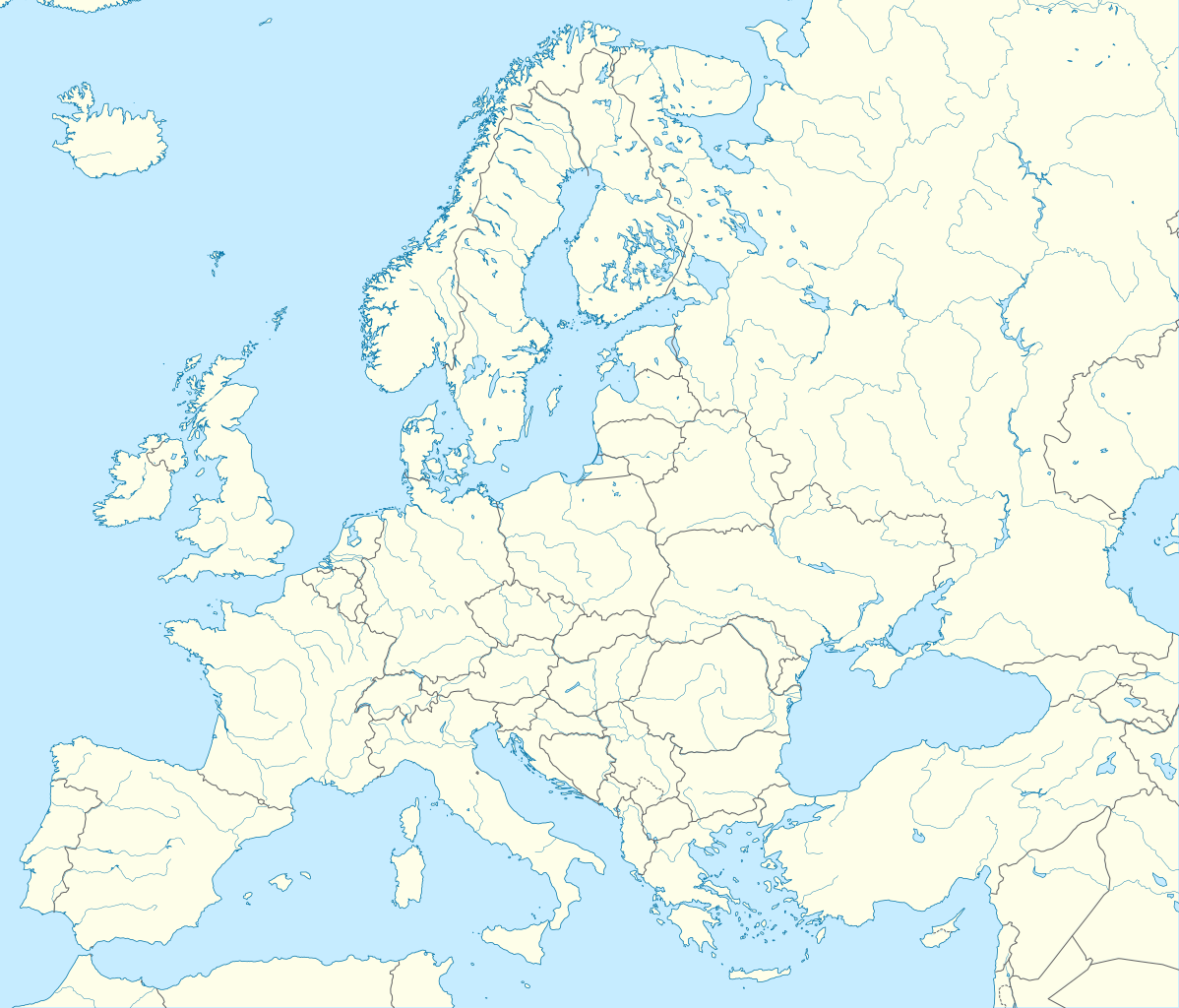
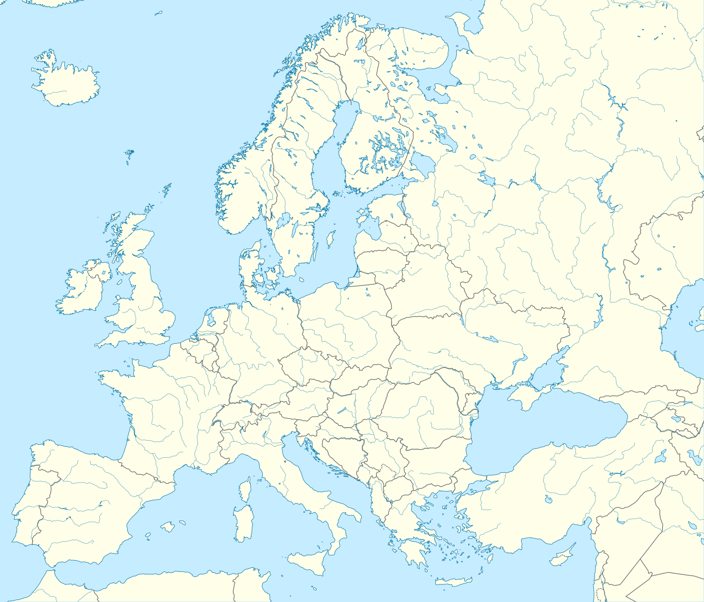
Deutsch: Positionskarte Europa; Politisch mit Staatsgrenzen, Inlandgewässer; Flächentreue Azimutalprojektion
English: Location map Europe; Political with state boundaries, inland water; Lambert azimuthal equal-area projection
Français : Carte de localisation Europe; Politique avec frontières d'Etats, mers intérieures; projection de Lambert azimuthale
Русский: Политическая карта Европы с границами государств и внутренними водами по состоянию на 2010 год (равновеликая азимутальная проекция Ламберта)
|
||
| Data | |||
| Origine |
Obra proprie
|
||
| Autor | Alexrk2 | ||
| Altere versiones |
Derivative works of this file:
[]
|
||
| SVG genesis |
|


.svg)


Licentia
Io, titular del derecto de autor sur iste obra, declara de publicar lo sub le sequente licentia:
Iste file es disponibile sub le licentia Creative Commons Attribution-CompartiSimile 3.0 Non-localisate.
- Tu es libere:
- de condivider – de copiar, distribuer e transmitter le obra
- de remixar – de adaptar le obra
- Sub le sequente conditiones:
- attribution – Tu debe dar information appropriate sur le autor, fornir un ligamine al licentia, e indicar si modificationes ha essite apportate. Tu pote facer lo de qualcunque maniera rationabile, ma non in alcun modo que suggere que le licentiator approba te o tu uso del obra.
- condivider equalmente – Si tu altera, transforma o disveloppa le material, tu debe distribuer tu contributiones sub un licentia identic o compatibile con le original.
Historia del file
Clicca sur un data/hora pro vider le file como appareva a ille tempore.
| Data/Hora | Miniatura | Dimensiones | Usator | Commento | |
|---|---|---|---|---|---|
| actual | 22:57, 20 augusto 2012 | | 1 401 × 1 198 (2,21 MB) | McZusatz | Reverted to version as of 19:40, 10 March 2010 (...thumb fixed?) |
| 22:56, 20 augusto 2012 |  | 1 401 × 1 198 (1,45 MB) | McZusatz | Reverted to version as of 18:44, 10 March 2010 (fixing thumb...) | |
| 19:40, 10 martio 2010 |  | 1 401 × 1 198 (2,21 MB) | Alexrk2 | +San Marino, enh. coastline & countries | |
| 18:44, 10 martio 2010 |  | 1 401 × 1 198 (1,45 MB) | Alexrk2 | == Summary == {{Information |Description= {{de|Positionskarte Europa; Politisch mit Staatsgrenzen, Inlandgewässer; Flächentreue Azimutalprojektion}} {{en|Location map Europe; Political with state boundaries, inland water; L |
Uso de iste file
Le sequente pagina usa iste file:
Uso global de iste file
Le altere wikis sequente usa iste imagine:
- Uso in als.wikipedia.org
- Uso in an.wikipedia.org
- Uso in av.wikipedia.org
- Uso in az.wikipedia.org
- Dunay
- Reyn
- UEFA Çempionlar Liqası 1994/1995
- UEFA Çempionlar Liqası 2007/2008
- Şablon:Yer xəritəsi Avropa
- Aqriate
- Akkona (səhra)
- Bardenas-Reales
- Pişinas
- Tabernas (səhra)
- Aleşkov qumları
- Mançester Arenada terror (2017)
- Avropa Gənclər Olimpiya Festivalı
- UEFA Çempionlar Liqası 2017/2018
- Yan çayı
- UEFA Çempionlar Liqası 2018/2019
- Moneqros səhrası
- UEFA Çempionlar Liqası 2019/2020
- UEFA Çempionlar Liqası 2020/2021
- UEFA Çempionlar Liqası 2021/2022
- Uso in ba.wikipedia.org
Vider altere usos global de iste file.