File:Krt 1510 full.jpg

Dimension de iste previsualisation: 800 × 600 pixels.Altere resolutiones: 320 × 240 pixels | 640 × 480 pixels | 1 024 × 768 pixels | 1 280 × 960 pixels | 2 560 × 1 920 pixels | 4 000 × 3 000 pixels.
File original (4 000 × 3 000 pixels, dimension del file: 14,13 MB, typo MIME: image/jpeg)
Summario
| Description |
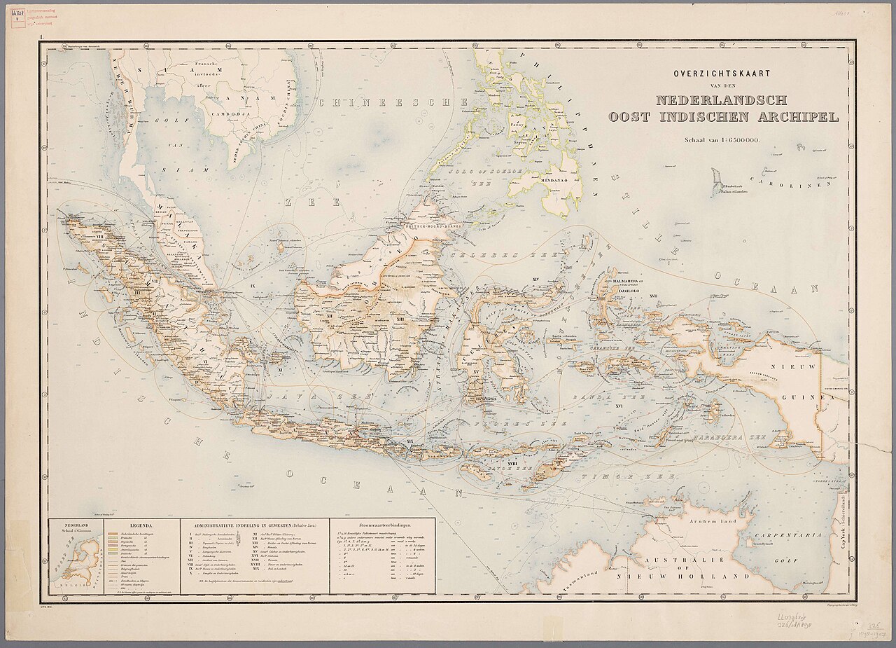
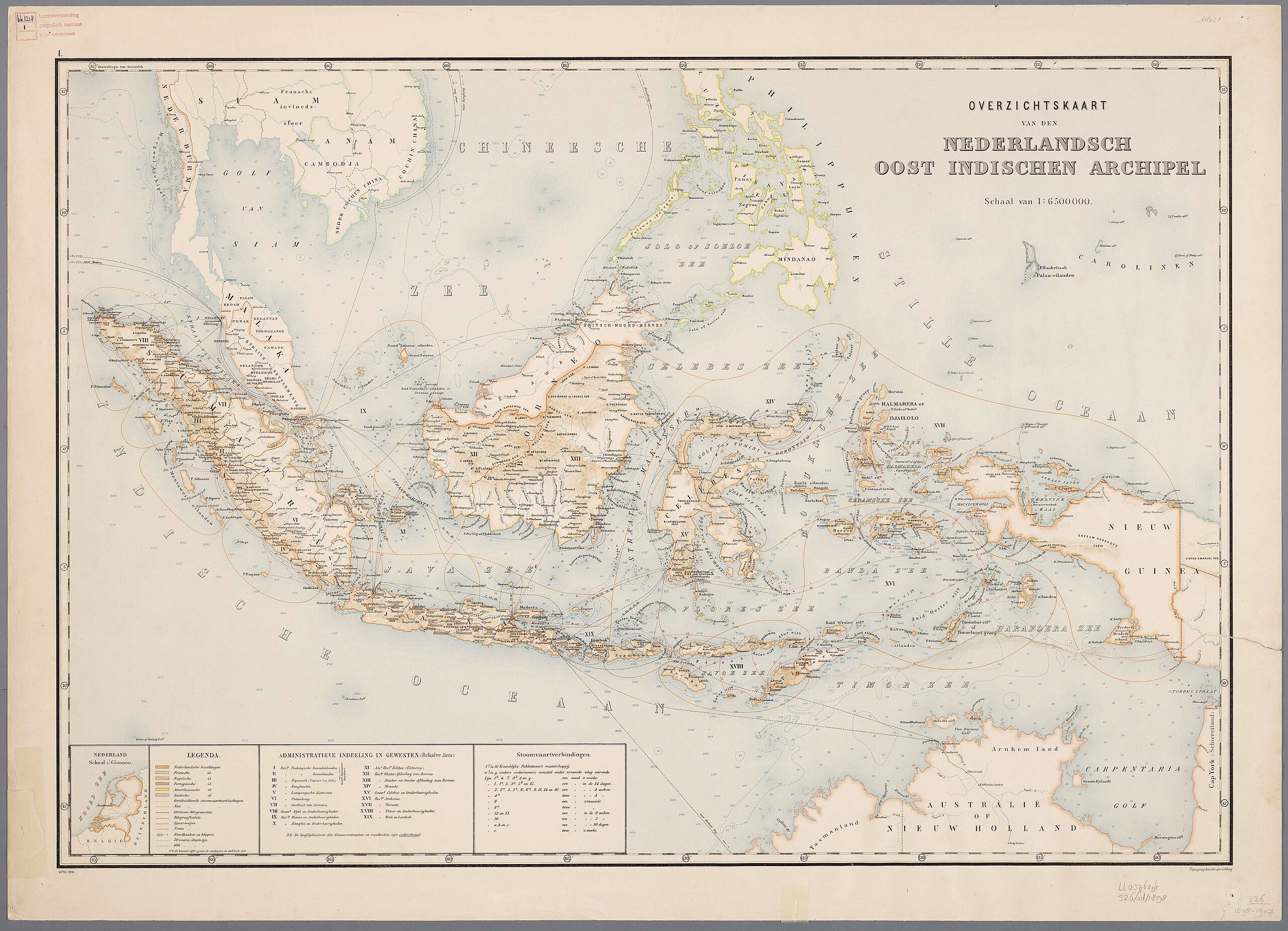
Nederlands: Atlas van Nederlandsch Oost-Indië / samengest. door Topographisch Bureau te Batavia van 1897-1904 |
| Data | 1897-1904 |
| Origine |
https://vu.contentdm.oclc.org/digital/collection/krt/id/1510 or https://digitalcollections.universiteitleiden.nl/view/item/2014658 restored and enchanced by u/helloVizart |
| Autor | Topographisch Bureau, Batavia |
| Altere versiones |
.jpg)
.jpg)


|
This work is in the public domain in its country of origin and other countries and areas where the copyright term is the author's life plus 70 years or fewer.
| |
| Iste file ha essite identificate como essente libere de restrictiones cognoscite sub lege de copyright, incluse tote le derectos connexe e vicin. | |
Historia del file
Clicca sur un data/hora pro vider le file como appareva a ille tempore.
| Data/Hora | Miniatura | Dimensiones | Usator | Commento | |
|---|---|---|---|---|---|
| actual | 06:44, 8 augusto 2023 | | 4 000 × 3 000 (14,13 MB) | Bennylin | restored and enchanced by u/helloVizart |
| 06:41, 8 augusto 2023 |  | 4 555 × 3 292 (1,81 MB) | Bennylin | {{Information |Description={{nl|Atlas van Nederlandsch Oost-Indië / samengest. door Topographisch Bureau te Batavia van 1897-1904<br /> 1. Overzichtskaart van den Nederlandsch Oost Indischen Archipel}} |Source=https://vu.contentdm.oclc.org/digital/collection/krt/id/1510 |Date=1897-1904 |Author=Topographisch Bureau, Batavia |Permission= |other_versions= }} {{PD-old}} Category:Old maps of Indonesia |
Uso de iste file
Le sequente pagina usa iste file:
Uso global de iste file
Le altere wikis sequente usa iste imagine: