File:Pulaski Skyway full view.jpg
Dimension de iste previsualisation: 750 × 600 pixels.Altere resolutiones: 300 × 240 pixels | 600 × 480 pixels | 960 × 768 pixels | 1 280 × 1 024 pixels | 2 560 × 2 048 pixels | 3 000 × 2 400 pixels.
File original (3 000 × 2 400 pixels, dimension del file: 1,56 MB, typo MIME: image/jpeg)
| Description |
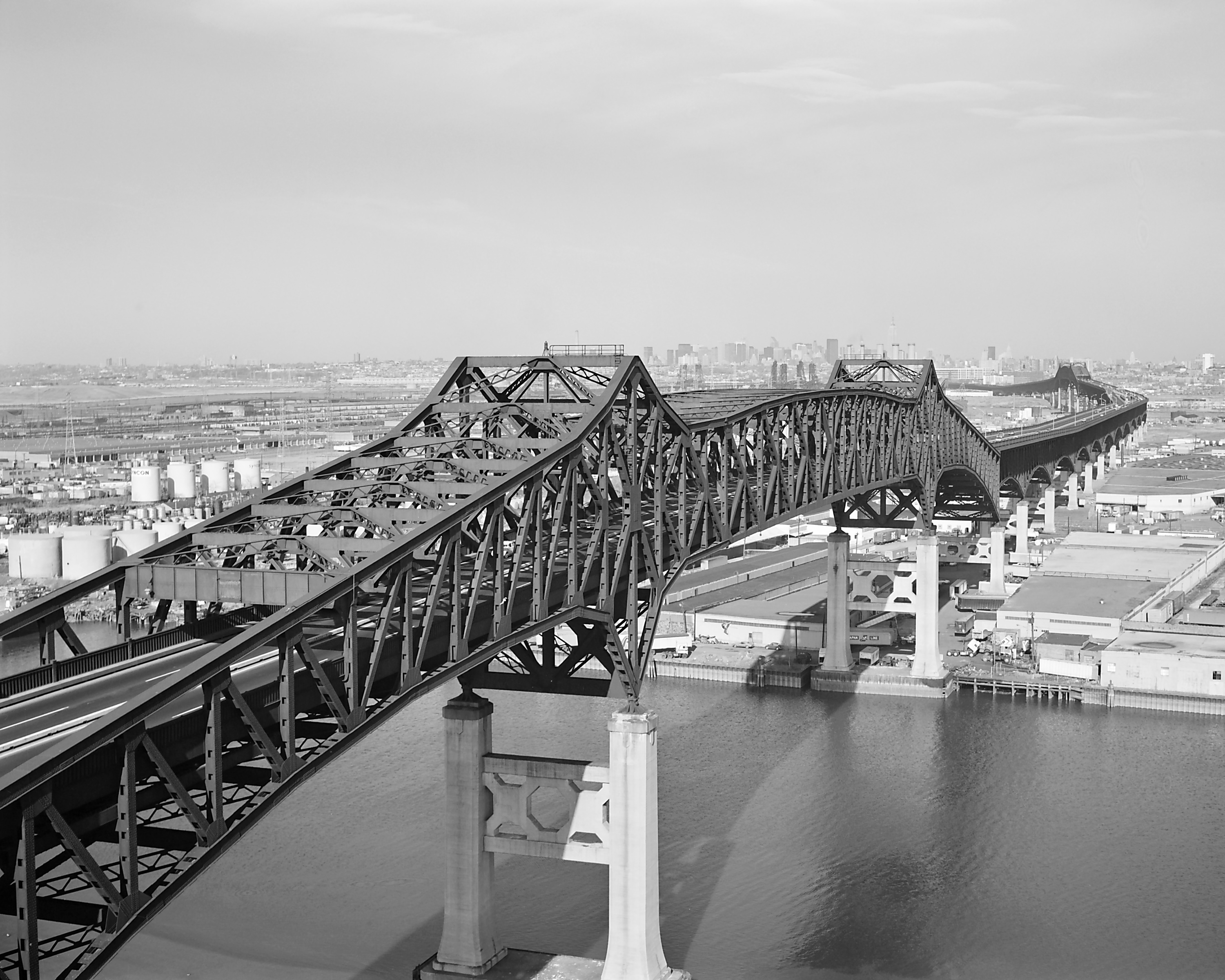
English: Pulaski Skyway — spanning the Passaic & Hackensack Rivers, Jersey City, Hudson County, New Jersey.
Français : Pont du général Pulaski, sur les fleuves Passaic et Hackensack, à Jersey City, dans le New Jersey, en 1978. Vue en gros plan et de biais depuis l'amont de la section franchissant la Passaic River. |
|||||||||||||||||||||||||
| Data | ||||||||||||||||||||||||||
| Origine |
|
|||||||||||||||||||||||||
| Autor |
|
|||||||||||||||||||||||||
| Permission (Reuso de iste file) |
|
|||||||||||||||||||||||||

| Camera location | | View this and other nearby images on: OpenStreetMap |
|---|
|
This image was selected as picture of the day on Wikimedia Commons for 4 March 2005. It was captioned as follows: English: Pulaski Skyway, New Jersey, USA Other languages:
English: Pulaski Skyway, New Jersey, USA Español: Pulaski Skyway, Nueva Jersey, EE.UU. Esperanto: Pulaski Skyway kie estas en Nov-Ĵerzejo en Usono. Italiano: Sopraelevata Pulaski, New Jersey USA. Nederlands: De Pulaski Skyway in New Jersey, VS Suomi: Pulaski Skyway, New Jersey, Yhdysvallat Svenska: Motorvägsbron "Pulaski skyway" i New Jersey, U.S.A. Български: "Пуласки Скайуей", Ню Джърски, САЩ 日本語: 米国・ニュージャージー州のプラスキー・スカイウェイ |
Historia del file
Clicca sur un data/hora pro vider le file como appareva a ille tempore.
| Data/Hora | Miniatura | Dimensiones | Usator | Commento | |
|---|---|---|---|---|---|
| actual | 20:44, 13 januario 2005 | | 3 000 × 2 400 (1,56 MB) | MarkSweep | replaced existing file: cleaner (and therefore smaller) version, better tonality, sharper |
| 17:22, 12 januario 2005 |  | 3 000 × 2 400 (1,7 MB) | MarkSweep | replaced exiting file: different crop, restored 4x5 aspect ratio | |
| 00:51, 11 januario 2005 |  | 4 828 × 2 493 (1,26 MB) | SPUI~commonswiki | {{HABS}} A 1978 view of the Pulaski Skyway. Taken by Jack Boucher. |
Uso de iste file
Le sequente pagina usa iste file:
Uso global de iste file
Le altere wikis sequente usa iste imagine:
- Uso in bg.wikipedia.org
- Uso in bn.wikipedia.org
- Uso in ca.wikipedia.org
- Uso in de.wikipedia.org
- Uso in de.wikivoyage.org
- Uso in en.wikipedia.org
- U.S. Route 1
- Pulaski Skyway
- Cantilever bridge
- Wikipedia:Today's featured article/January 2005
- Wikipedia:Today's featured article/January 29, 2005
- Portal:U.S. roads/Selected article
- Portal:New Jersey/Selected article
- User:Nauticashades/FPC
- Wikipedia:Featured picture candidates/Pulaski Skyway
- Wikipedia:Featured picture candidates/October-2006
- National Register of Historic Places listings in Essex County, New Jersey
- Portal:U.S. roads/Selected article/April 2006
- List of bridges on the National Register of Historic Places in New Jersey
- Portal:New Jersey/Selected article/5
- Transportation in New Jersey
- Wikipedia:WikiProject U.S. Roads/New Jersey/Selected article
- Wikipedia:WikiProject U.S. Roads/New Jersey/Selected article/July 2010
- Wikipedia:Valued picture candidates/August-2010
- Wikipedia:Valued picture candidates/Pulaski Skyway
- List of crossings of the Lower Passaic River
- Sigvald Johannesson
- Talk:Fort Lee lane closure scandal/Archive 3
- User talk:Jack/Archive 2010
- Uso in en.wikivoyage.org
- Uso in es.wikipedia.org
- Uso in fi.wikipedia.org
- Uso in fr.wikipedia.org
- Liste de ponts aux États-Unis
- Wikipédia:Image du jour/4 mars 2005
- Wikipédia:Image du jour/mars 2005
- U.S. Route 1
- Liste des ponts les plus longs du monde
- Wikipédia:Le Bistro/31 mai 2009
- Utilisateur:Glabb/Brouillon/Liste des ponts les plus longs du monde
- Utilisateur:Roland45/Ponts les plus longs du monde
- Wikipédia:Le Bistro/Galerie/2009
- Wikipédia:Le Bistro/Galerie/Mai
- Pulaski Skyway
- Uso in ko.wikipedia.org
Vider altere usos global de iste file.