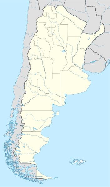
File:Argentina location map.svg

Dimension de iste previsualisation PNG de iste file SVG: 352 × 599 pixels. Altere resolutiones: 141 × 240 pixels | 282 × 480 pixels | 451 × 768 pixels | 602 × 1 024 pixels | 1 204 × 2 048 pixels | 1 418 × 2 412 pixels.
File original (File SVG, dimensiones nominal: 1 418 × 2 412 pixels, grandor del file: 1,03 MB)
Summario
.svg)
.svg)

|
This map has been made or improved in the German Kartenwerkstatt (Map Lab). You can propose maps to improve as well.
|
Licentia
Io, titular del derecto de autor sur iste obra, declara de publicar lo sub le sequente licentias:

|
Le permission es concedite de copiar, distribuer e/o modificar iste documento sub le conditiones del Licentia GNU pro Documentation Libere, Version 1.2 o omne version plus recente publicate per le Fundation pro Software Libere; sin Sectiones Invariabile, sin Textos de Copertura Frontal e sin Textos de Copertura Posterior. Un copia del licentia es includite in le section titulate Licentia GNU pro Documentation Libere. |
Iste file es disponibile sub le licentia Creative Commons Attribution-CompartiSimile 3.0 Non-localisate.
- Tu es libere:
- de condivider – de copiar, distribuer e transmitter le obra
- de remixar – de adaptar le obra
- Sub le sequente conditiones:
- attribution – Tu debe dar information appropriate sur le autor, fornir un ligamine al licentia, e indicar si modificationes ha essite apportate. Tu pote facer lo de qualcunque maniera rationabile, ma non in alcun modo que suggere que le licentiator approba te o tu uso del obra.
- condivider equalmente – Si tu altera, transforma o disveloppa le material, tu debe distribuer tu contributiones sub un licentia identic o compatibile con le original.
Tu pote seliger le licentia de tu preferentia.
Historia del file
Clicca sur un data/hora pro vider le file como appareva a ille tempore.
| Data/Hora | Miniatura | Dimensiones | Usator | Commento | |
|---|---|---|---|---|---|
| actual | 15:26, 11 augusto 2022 | | 1 418 × 2 412 (1,03 MB) | Janitoalevic | Reverted to version as of 02:18, 25 May 2021 (UTC) |
| 00:27, 9 maio 2022 |  | 1 418 × 2 412 (1,51 MB) | Buttons0603 | Reverted to version as of 20:33, 29 January 2021 (UTC) see below | |
| 02:18, 25 maio 2021 |  | 1 418 × 2 412 (1,03 MB) | MinervaAustral | Reverted to version as of 03:37, 24 November 2018 (UTC) | |
| 20:33, 29 januario 2021 |  | 1 418 × 2 412 (1,51 MB) | Buttons0603 | Reverted to version as of 13:13, 23 November 2018 (UTC) There is already a version with the Falklands in white at File:Argentina location map (+Falkland).svg for when such a map is needed. | |
| 03:37, 24 novembre 2018 |  | 1 418 × 2 412 (1,03 MB) | Cacen Gymraeg | Reverted to version as of 01:43, 6 November 2017 (UTC). Added claim territories (neutral point of view) | |
| 13:13, 23 novembre 2018 |  | 1 418 × 2 412 (1,51 MB) | Mr. James Dimsey | Reverted to version as of 23:25, 9 October 2015 (UTC) | |
| 01:43, 6 novembre 2017 |  | 1 418 × 2 412 (1,03 MB) | Janitoalevic | Added Fontana and Plata Lake. | |
| 01:37, 6 novembre 2017 |  | 1 418 × 2 412 (1,02 MB) | Janitoalevic | Fixed provincial and international borders. | |
| 21:36, 25 martio 2016 |  | 1 418 × 2 412 (997 KB) | Janitoalevic | Added all the Disputed Territories | |
| 19:00, 21 martio 2016 |  | 1 418 × 2 412 (994 KB) | Gustavo Girardelli | Detalles. |
.svg)
Uso de iste file
Le sequente pagina usa iste file:
Uso global de iste file
Le altere wikis sequente usa iste imagine:
- Uso in af.wikipedia.org
- Comodoro Rivadavia
- Mar del Plata
- Bariloche
- La Plata
- Villa General Belgrano
- FIFA Sokker-Wêreldbekertoernooi in 1978
- Balcarce
- Sarmiento
- Sjabloon:Liggingkaart Argentinië
- Monserrat, Buenos Aires
- Aconcagua
- Ojos del Salado
- Los Toldos
- Coloradorivier (Argentinië)
- Rawson
- Ministro Pistarini Internasionale Lughawe
- Uso in an.wikipedia.org
- Uso in ar.wikipedia.org
- Uso in ast.wikipedia.org
- Buenos Aires
- Abbott
- Agote (Buenos Aires)
- La Plata
- Partido de La Plata
- Abasto (La Plata)
- Ángel Etcheverry
- Arturo Seguí
- City Bell
- Joaquín Gorina
- José Hernández (Buenos Aires)
- Manuel B. Gonnet
- Ringuelet
- Tolosa (Buenos Aires)
- Villa Elvira
- El Peligro (La Plata)
- San Carlos (Buenos Aires)
- Ríu de la Plata
- Mendoza (Arxentina)
- Costa de Reyes
- Santa Cruz (Catamarca)
- Las Tejas
Vider altere usos global de iste file.