File:CAN orthographic.svg

Dimension de iste previsualisation PNG de iste file SVG: 551 × 551 pixels. Altere resolutiones: 240 × 240 pixels | 480 × 480 pixels | 768 × 768 pixels | 1 024 × 1 024 pixels | 2 048 × 2 048 pixels.
File original (File SVG, dimensiones nominal: 551 × 551 pixels, grandor del file: 1,83 MB)
Summario
| Description |
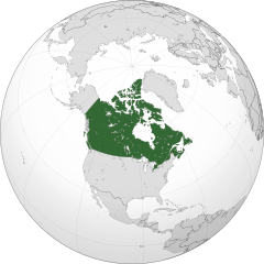
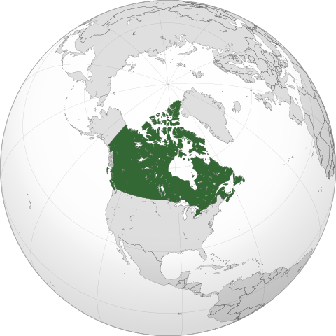
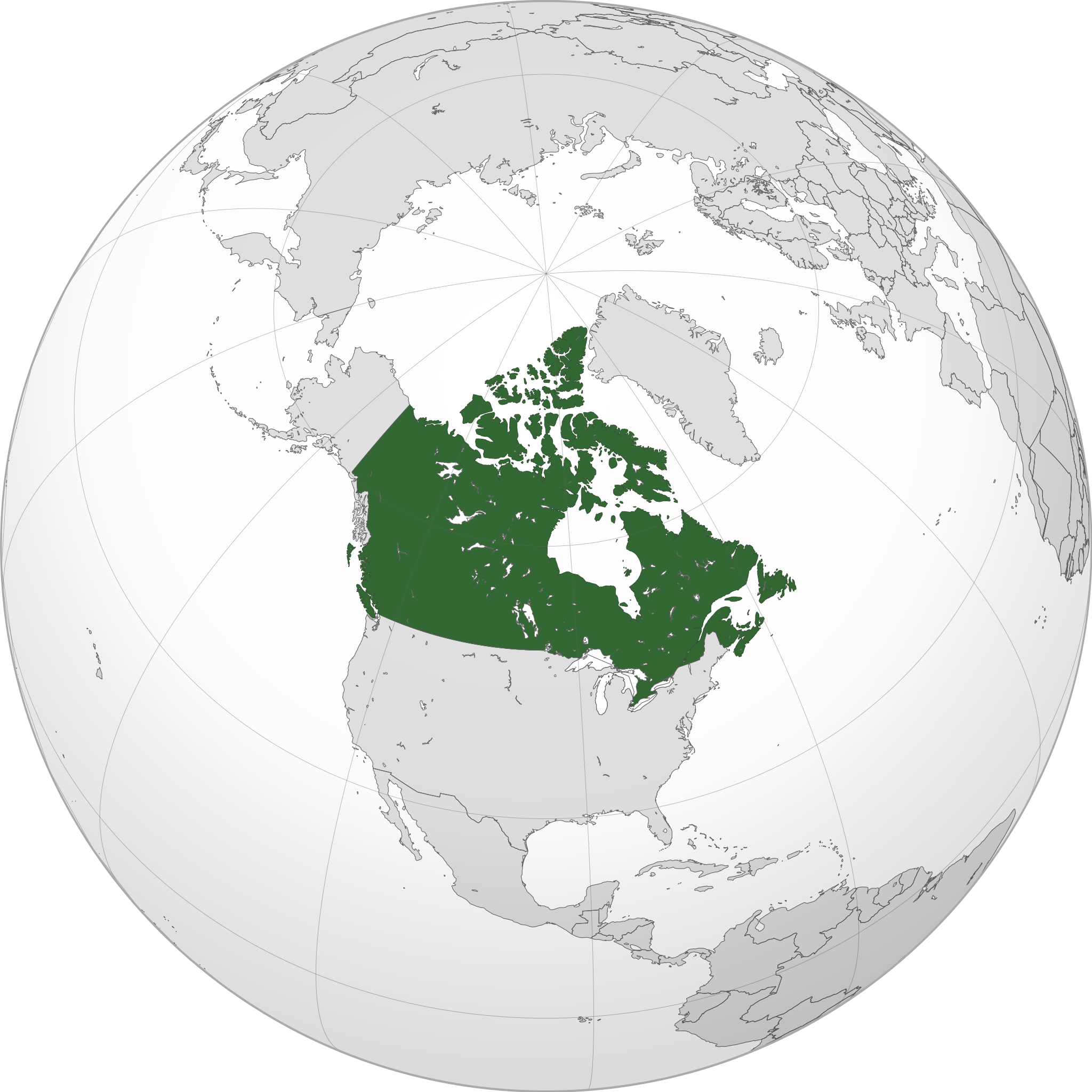
English: A map of the hemisphere centred on -95, 60, using an orthographic projection, created using gringer's Perl script with Natural Earth Data (1:50000 resolution, simplified to 0.25px). Canada is highlighted in green.
Official territory. Claimed territories. |
| Data | |
| Origine | Obra proprie with Natural Earth Data |
| Autor | Addicted04 |
| SVG genesis |
.svg)
.svg)
.svg)
.svg)
.svg)
.svg)
.svg)
.svg)
.svg)
.svg)
.svg)
.svg)
.svg)
.svg)
.svg)
.svg)
.svg)
.svg)
.svg)
.svg)
.svg)
.svg)
.svg)
.svg)
.svg)
.svg)
.svg)
.svg)
.svg)
.svg)
.svg)
.svg)
.svg)
.svg)
.svg)
.svg)
.svg)
.svg)
.svg)
.svg)
.svg)
.svg)
.svg)
.svg)
.svg)
.svg)
.svg)
.svg)
.svg)
.svg)
.svg)
.svg)
.svg)
.svg)
.svg)
.svg)
.svg)
.svg)
.svg)
.svg)
.svg)
.svg)
.svg)
.svg)
.svg)
.svg)
.svg)
.svg)
.svg)
.svg)
.svg)
.svg)
.svg)
.svg)

.svg)

.svg)

.svg)
.svg)
.svg)
.svg)
.svg)
.svg)
.svg)


.svg)
.svg)
.svg)
.svg)
.svg)
.svg)
.svg)

.svg)
.svg)
.svg)
.svg)
.svg)
.svg)
.svg)
.svg)
.svg)

.svg)
.svg)
.svg)
.svg)
.svg)
.svg)
.svg)
_without_national_boundaries.svg)
.svg)
.svg)
.svg)
.svg)
.svg)
.svg)

.svg)
.svg)
.png)
.svg)
.svg)
.svg)
.svg)

.svg)
.svg)
.svg)
.svg)
.svg)
.svg)
.svg)
.svg)
.svg)
.svg)
.svg)

.svg)
.svg)
.svg)
.svg)
.svg)
.svg)
.svg)
.svg)
.svg)

.svg)
.svg)

.svg)
.svg)
.svg)
.svg)
.svg)
.svg)
.svg)
.svg)
.svg)
.svg)
.svg)
.svg)
.svg)
.svg)
.svg)
.svg)
.svg)
.svg)
.svg)
.svg)
.svg)
.svg)
.svg)
.svg)
.svg)
.svg)
.svg)
_-_Crimea_disputed.svg)
.svg)
.svg)
.svg)
.svg)
.svg)
.svg)
.svg)
.svg)
.svg)
.svg)
.svg)
_political.svg)
.svg)
.svg)
.svg)
.svg)
_-_Crimea_disputed_-_no_borders.svg)
.svg)
.svg)
.svg)
.svg)
.svg)
.svg)
.svg)
.svg)
.svg)
.svg)
.svg)

.svg)
.svg)
.svg)

.png)
.svg)
.svg)
.svg)
.svg)
.svg)
.svg)
.svg)
.svg)
.svg)
.svg)
.svg)
.svg)
.svg)
.svg)
.svg)
.svg)
.svg)
.svg)
.svg)
.svg)
.svg)
.svg)
.svg)
.svg)
.svg)
.svg)
.svg)
.svg)
.svg)
.svg)
.svg)
.svg)
.svg)
.svg)
.png)
.svg)
.svg)
.svg)
_(orthographic_projection).png)
| Orthographic projections maps created by Ssolbergj |
|---|
| Orthographic projections maps created by Ssolbergj: |
.svg)
.svg)
Licentia
Io, titular del derecto de autor sur iste obra, declara de publicar lo sub le sequente licentia:
Iste file es disponibile sub le licentia Creative Commons Attribution-CompartiSimile 3.0 Non-localisate.
- Tu es libere:
- de condivider – de copiar, distribuer e transmitter le obra
- de remixar – de adaptar le obra
- Sub le sequente conditiones:
- attribution – Tu debe dar information appropriate sur le autor, fornir un ligamine al licentia, e indicar si modificationes ha essite apportate. Tu pote facer lo de qualcunque maniera rationabile, ma non in alcun modo que suggere que le licentiator approba te o tu uso del obra.
- condivider equalmente – Si tu altera, transforma o disveloppa le material, tu debe distribuer tu contributiones sub un licentia identic o compatibile con le original.
Historia del file
Clicca sur un data/hora pro vider le file como appareva a ille tempore.
| Data/Hora | Miniatura | Dimensiones | Usator | Commento | |
|---|---|---|---|---|---|
| actual | 00:05, 19 januario 2014 | | 551 × 551 (1,83 MB) | Addicted04 | New map |
| 21:37, 19 septembre 2011 |  | 550 × 550 (1,31 MB) | Addicted04 | Western islands | |
| 01:29, 19 septembre 2011 |  | 550 × 550 (1,31 MB) | Addicted04 |
Uso de iste file
Le sequente 3 paginas usa iste file:
Uso global de iste file
Le altere wikis sequente usa iste imagine:
- Uso in am.wikipedia.org
- Uso in ar.wikipedia.org
- كندا
- مستخدم:وهراني/ملعب
- مستخدم:جار الله/قائمة صور مقالات العلاقات الثنائية
- العلاقات الأنغولية الكندية
- العلاقات الكندية الكورية الجنوبية
- العلاقات الإريترية الكندية
- العلاقات السويسرية الكندية
- العلاقات الألمانية الكندية
- العلاقات الكندية الليختنشتانية
- العلاقات البوليفية الكندية
- العلاقات الكندية الموزمبيقية
- العلاقات الألبانية الكندية
- العلاقات البلجيكية الكندية
- العلاقات الإثيوبية الكندية
- العلاقات البيلاروسية الكندية
- العلاقات الطاجيكستانية الكندية
- العلاقات الروسية الكندية
- العلاقات الرومانية الكندية
- العلاقات الأرجنتينية الكندية
- العلاقات الغامبية الكندية
- العلاقات القبرصية الكندية
- العلاقات السيراليونية الكندية
- العلاقات الكندية النيبالية
- العلاقات الكندية الليبيرية
- العلاقات التشيكية الكندية
- العلاقات الكندية الميانمارية
- العلاقات الزيمبابوية الكندية
- العلاقات الإسرائيلية الكندية
- العلاقات البالاوية الكندية
- العلاقات الكندية النيجيرية
- العلاقات اليمنية الكندية
- العلاقات الفانواتية الكندية
- العلاقات الغابونية الكندية
- العلاقات البنمية الكندية
- العلاقات الكندية الكوبية
- العلاقات الجورجية الكندية
- العلاقات التونسية الكندية
- العلاقات الكندية الكورية الشمالية
- العلاقات الهندية الكندية
- العلاقات الإيطالية الكندية
- العلاقات الكندية الناوروية
- العلاقات الأسترالية الكندية
- العلاقات الزامبية الكندية
- العلاقات الفيجية الكندية
- العلاقات المارشالية الكندية
- العلاقات الأذربيجانية الكندية
- العلاقات السودانية الكندية
- العلاقات الكويتية الكندية
- العلاقات الكندية الكونغوية
Vider altere usos global de iste file.