File:Canada upper lower map.PNG

Dimension de iste previsualisation: 800 × 521 pixels.Altere resolutiones: 320 × 208 pixels | 640 × 417 pixels | 1 024 × 667 pixels | 1 280 × 833 pixels | 1 688 × 1 099 pixels.
File original (1 688 × 1 099 pixels, dimension del file: 73 KB, typo MIME: image/png)
Summario
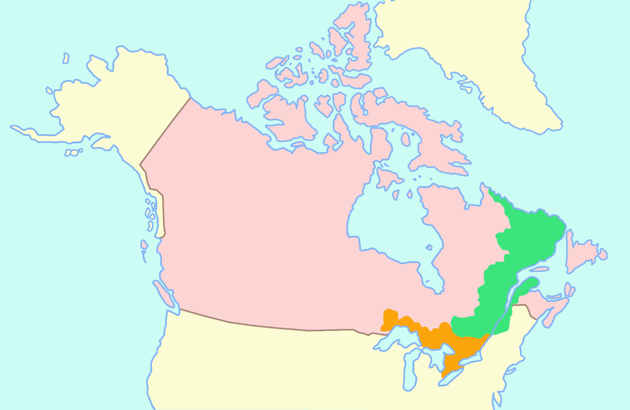
Map of Upper and (prior to 1809, including Labrador) Lower Canada, together known as The Canadas. Made by User:Astrokey44 from information from several maps of Canada. On the map, Lower Canada (northeast of Upper Canada) is shown in green, and Upper Canada (next to the Great Lakes) is shown in orange. The large expanse of the rest of modern-day Canada is shown in pink.
Licentia

|
Le permission es concedite de copiar, distribuer e/o modificar iste documento sub le conditiones del Licentia GNU pro Documentation Libere, Version 1.2 o omne version plus recente publicate per le Fundation pro Software Libere; sin Sectiones Invariabile, sin Textos de Copertura Frontal e sin Textos de Copertura Posterior. Un copia del licentia es includite in le section titulate Licentia GNU pro Documentation Libere. |
| Iste file es disponibile sub le licentia Creative Commons Attribution-CompartiSimile 3.0 Non-localisate. | ||
| ||
| Iste etiquetta de licentia esseva addite a iste file como parte del actualisation del licentia GFDL. |
Historia del file
Clicca sur un data/hora pro vider le file como appareva a ille tempore.
| Data/Hora | Miniatura | Dimensiones | Usator | Commento | |
|---|---|---|---|---|---|
| actual | 10:24, 13 februario 2006 | | 1 688 × 1 099 (73 KB) | Roke~commonswiki | Map of Upper and Lower Canada Category: Maps of Canada |
Uso de iste file
Le sequente pagina usa iste file:
Uso global de iste file
Le altere wikis sequente usa iste imagine:
- Uso in ar.wikipedia.org
- Uso in az.wikipedia.org
- Uso in ca.wikipedia.org
- Uso in cs.wikipedia.org
- Uso in da.wikipedia.org
- Uso in de.wikipedia.org
- Uso in en.wikipedia.org
- Uso in eo.wikipedia.org
- Uso in es.wikipedia.org
- Uso in eu.wikipedia.org
- Uso in fi.wikipedia.org
- Uso in fr.wikipedia.org
- Uso in gl.wikipedia.org
- Uso in he.wikipedia.org
- Uso in hr.wikipedia.org
- Uso in id.wikipedia.org
- Uso in it.wikipedia.org
- Uso in ja.wikipedia.org
- Uso in ko.wikipedia.org
- Uso in mt.wikipedia.org
- Uso in nl.wikipedia.org
- Uso in om.wikipedia.org
- Uso in pam.wikipedia.org
- Uso in pl.wikipedia.org
- Uso in pt.wikipedia.org
- Uso in ro.wikipedia.org
- Uso in ru.wikipedia.org
- Uso in sv.wikipedia.org
- Uso in tr.wikipedia.org
- Uso in uk.wikipedia.org
- Uso in vi.wikipedia.org
- Uso in www.wikidata.org
Vider altere usos global de iste file.