File:Colombia relief location map.jpg

Dimension de iste previsualisation: 530 × 600 pixels.Altere resolutiones: 212 × 240 pixels | 424 × 480 pixels | 679 × 768 pixels | 905 × 1 024 pixels | 2 028 × 2 294 pixels.
File original (2 028 × 2 294 pixels, dimension del file: 1,1 MB, typo MIME: image/jpeg)
Summario


.svg)


|
This map has been made or improved in the German Kartenwerkstatt (Map Lab). You can propose maps to improve as well.
|
Licentia
Io, titular del derecto de autor sur iste obra, declara de publicar lo sub le sequente licentia:
Iste file es disponibile sub le licentia Creative Commons Attribution-CompartiSimile 3.0 Non-localisate.
- Tu es libere:
- de condivider – de copiar, distribuer e transmitter le obra
- de remixar – de adaptar le obra
- Sub le sequente conditiones:
- attribution – Tu debe dar information appropriate sur le autor, fornir un ligamine al licentia, e indicar si modificationes ha essite apportate. Tu pote facer lo de qualcunque maniera rationabile, ma non in alcun modo que suggere que le licentiator approba te o tu uso del obra.
- condivider equalmente – Si tu altera, transforma o disveloppa le material, tu debe distribuer tu contributiones sub un licentia identic o compatibile con le original.
Historia del file
Clicca sur un data/hora pro vider le file como appareva a ille tempore.
| Data/Hora | Miniatura | Dimensiones | Usator | Commento | |
|---|---|---|---|---|---|
| actual | 06:53, 16 februario 2015 | | 2 028 × 2 294 (1,1 MB) | Milenioscuro | same dimensions of locator map.svg |
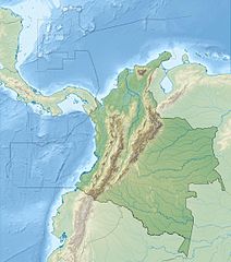
| 12:38, 6 februario 2010 |  | 1 516 × 1 736 (901 KB) | Alexrk2 | {{Information |Description= {{de|Physische Positionskarte von Kolumbien Quadratische Plattkarte. Geographische Begrenzung der Karte:}} {{en|Physical Location map of Colombia Equirectangular projection. Geographic limits |
Uso de iste file
Il non ha paginas que usa iste file.
Uso global de iste file
Le altere wikis sequente usa iste imagine:
- Uso in als.wikipedia.org
- Uso in ar.wikipedia.org
- Uso in ast.wikipedia.org
- Uso in avk.wikipedia.org
- Uso in azb.wikipedia.org
- Uso in az.wikipedia.org
- Uso in ban.wikipedia.org
- Uso in ba.wikipedia.org
- Uso in be.wikipedia.org
- Uso in bg.wikipedia.org
Vider altere usos global de iste file.