File:Iraq (orthographic projection).svg

Dimension de iste previsualisation PNG de iste file SVG: 600 × 600 pixels. Altere resolutiones: 240 × 240 pixels | 480 × 480 pixels | 768 × 768 pixels | 1 024 × 1 024 pixels | 2 048 × 2 048 pixels | 680 × 680 pixels.
File original (File SVG, dimensiones nominal: 680 × 680 pixels, grandor del file: 319 KB)
Summario
| Description |
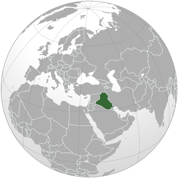
Čeština: Lokalizace Iráku v rámci světa (ortografická projekce). |
| Data | |
| Origine | Obra proprie |
| Autor | |
| Altere versiones |
.svg) |
| SVG genesis | This W3C-invalid world map was created with Adobe Illustrator, and with Inkscape. |
.svg)
.svg)
.svg)
.svg)
.svg)
.svg)
.svg)
.svg)
.svg)
.svg)
.svg)
.svg)
.svg)
.svg)
.svg)
.svg)
.svg)
.svg)
.svg)
.svg)
.svg)
.svg)
.svg)
.svg)
.svg)
.svg)
.svg)
.svg)
.svg)
.svg)
.svg)
.svg)
.svg)
.svg)
.svg)
.svg)
.svg)
.svg)
.svg)
.svg)
.svg)
.svg)
.svg)
.svg)
.svg)
.svg)
.svg)
.svg)
.svg)
.svg)
.svg)
.svg)
.svg)
.svg)
.svg)
.svg)
.svg)
.svg)
.svg)
.svg)
.svg)
.svg)
.svg)
.svg)
.svg)
.svg)
.svg)
.svg)
.svg)
.svg)
.svg)
.svg)
.svg)

.svg)

.svg)

.svg)
.svg)
.svg)
.svg)
.svg)
.svg)
.svg)


.svg)
.svg)
.svg)
.svg)
.svg)
.svg)
.svg)

.svg)
.svg)
.svg)
.svg)
.svg)
.svg)
.svg)
.svg)
.svg)

.svg)
.svg)
.svg)
.svg)
.svg)
.svg)
.svg)
_without_national_boundaries.svg)
.svg)
.svg)
.svg)
.svg)
.svg)
.svg)

.svg)
.svg)
.png)
.svg)
.svg)
.svg)
.svg)

.svg)
.svg)
.svg)
.svg)
.svg)
.svg)
.svg)
.svg)
.svg)
.svg)
.svg)

.svg)
.svg)
.svg)
.svg)
.svg)
.svg)
.svg)
.svg)
.svg)

.svg)
.svg)

.svg)
.svg)
.svg)
.svg)
.svg)
.svg)
.svg)
.svg)
.svg)
.svg)
.svg)
.svg)
.svg)
.svg)
.svg)
.svg)
.svg)
.svg)
.svg)
.svg)
.svg)
.svg)
.svg)
.svg)
.svg)
.svg)
.svg)
_-_Crimea_disputed.svg)
.svg)
.svg)
.svg)
.svg)
.svg)
.svg)
.svg)
.svg)
.svg)
.svg)
.svg)
_political.svg)
.svg)
.svg)
.svg)
.svg)
_-_Crimea_disputed_-_no_borders.svg)
.svg)
.svg)
.svg)
.svg)
.svg)
.svg)
.svg)
.svg)
.svg)
.svg)
.svg)

.svg)
.svg)
.svg)

.png)
.svg)
.svg)
.svg)
.svg)
.svg)
.svg)
.svg)
.svg)
.svg)
.svg)
.svg)
.svg)
.svg)
.svg)
.svg)
.svg)
.svg)
.svg)
.svg)
.svg)
.svg)
.svg)
.svg)
.svg)
.svg)
.svg)
.svg)
.svg)
.svg)
.svg)
.svg)
.svg)
.svg)
.svg)
.png)
.svg)
.svg)
.svg)
_(orthographic_projection).png)
.svg)
Licentia
Io, titular del derecto de autor sur iste obra, declara de publicar lo sub le sequente licentia:
Iste file es disponibile sub le licentia Creative Commons Attribution-CompartiSimile 3.0 Non-localisate.
- Tu es libere:
- de condivider – de copiar, distribuer e transmitter le obra
- de remixar – de adaptar le obra
- Sub le sequente conditiones:
- attribution – Tu debe dar information appropriate sur le autor, fornir un ligamine al licentia, e indicar si modificationes ha essite apportate. Tu pote facer lo de qualcunque maniera rationabile, ma non in alcun modo que suggere que le licentiator approba te o tu uso del obra.
- condivider equalmente – Si tu altera, transforma o disveloppa le material, tu debe distribuer tu contributiones sub un licentia identic o compatibile con le original.
Historia del file
Clicca sur un data/hora pro vider le file como appareva a ille tempore.
.svg&dir=prev)
.svg&offset=20190116102903)
.svg&offset=&limit=20)
.svg&offset=&limit=50)
.svg&offset=&limit=100)
.svg&offset=&limit=250)
.svg&offset=&limit=500)
| Data/Hora | Miniatura | Dimensiones | Usator | Commento | |
|---|---|---|---|---|---|
| actual | 22:18, 3 martio 2020 | | 680 × 680 (319 KB) | Bidgee | Reverted to version as of 00:42, 3 March 2020 (UTC) per COM:OVERWRITE. Upload as a new file and do not overwrite existing ones |
| 12:44, 3 martio 2020 |  | 553 × 553 (290 KB) | SeifED23 | Reverted to version as of 19:42, 2 March 2020 (UTC) South Sudan is no longer part of Sudan since 2011 | |
| 00:42, 3 martio 2020 |  | 680 × 680 (319 KB) | Bidgee | Reverted to version as of 10:40, 16 January 2019 (UTC) per COM:OVERWRITE | |
| 19:42, 2 martio 2020 |  | 553 × 553 (290 KB) | SeifED23 | Reverted to version as of 11:16, 22 January 2019 (UTC) We don't remove South Sudan from the map of the location of Iraq | |
| 11:17, 22 januario 2019 |  | 680 × 680 (319 KB) | Nikki070 | Reverted to version as of 10:40, 16 January 2019 (UTC) | |
| 11:16, 22 januario 2019 |  | 553 × 553 (290 KB) | Nikki070 | Reverted to version as of 10:32, 16 January 2019 (UTC) | |
| 10:40, 16 januario 2019 |  | 680 × 680 (319 KB) | Bidgee | Reverted to version as of 05:45, 19 March 2015 (UTC) COM:OVERWRITE | |
| 10:32, 16 januario 2019 |  | 553 × 553 (290 KB) | Powerofgamers01 | Reverted to version as of 10:29, 16 January 2019 (UTC) | |
| 10:31, 16 januario 2019 |  | 680 × 680 (319 KB) | Powerofgamers01 | Reverted to version as of 05:45, 19 March 2015 (UTC) | |
| 10:29, 16 januario 2019 |  | 553 × 553 (290 KB) | Powerofgamers01 | Reverted to version as of 23:34, 16 March 2015 (UTC) |
Uso de iste file
Il non ha paginas que usa iste file.
Uso global de iste file
Le altere wikis sequente usa iste imagine:
- Uso in ar.wikipedia.org
- العراق
- سلطة الائتلاف المؤقتة
- الانتداب البريطاني على العراق
- القوة البحرية العراقية
- الجمهورية العراقية الأولى
- العراق إبان حكم حزب البعث
- العلاقات الألمانية العراقية
- العلاقات المصرية العراقية
- العلاقات العراقية الصينية
- العلاقات البرازيلية العراقية
- مستخدم:مؤمل الجبوري
- العلاقات العراقية الهندية
- العلاقات العراقية البلغارية
- العلاقات العراقية الكوبية
- العلاقات الإيطالية العراقية
- العلاقات العراقية الصربية
- العلاقات السويدية العراقية
- العلاقات العراقية البريطانية
- مستخدم:ثعلب شبه الجزيره/العراق
- نقاش المستخدم:ثعلب شبه الجزيره/العراق
- مستخدم:Turkmen oglu/صناديقي
- مستخدم:Bassammahdi
- مستخدم:MohammadHuzam
- بوابة:العالم الإسلامي/دولة مختارة/أرشيف
- بوابة:العالم الإسلامي/دولة مختارة/4
- قائمة ثدييات العراق
- قائمة الدول ذات السيادة والأقاليم التابعة في آسيا
- ويكيبيديا:مقالة الصفحة الرئيسية المختارة/433
- مستخدمة:Hadeelhh
- مستخدمة:Hadeelhh/صناديقي
- مستخدم:صفاء/صناديقي
- مستخدم:صندوق مستخدم/مستخدم شارك في مشروع ويكي العراق
- معاملة المثليين في العراق
- مستخدم:جار الله/قائمة صور مقالات العلاقات الثنائية
- العلاقات الأنغولية العراقية
- العلاقات العراقية الكورية الجنوبية
- العلاقات العراقية الإريترية
- العلاقات العراقية السويسرية
- العلاقات العراقية الليختنشتانية
- العلاقات العراقية البوليفية
- العلاقات العراقية الموزمبيقية
- العلاقات الألبانية العراقية
- العلاقات العراقية البلجيكية
- العلاقات العراقية الإثيوبية
- العلاقات العراقية الطاجيكستانية
- العلاقات العراقية الرومانية
- العلاقات الأرجنتينية العراقية
- العلاقات العراقية الغامبية
- العلاقات العراقية القبرصية
- العلاقات العراقية السيراليونية
Vider altere usos global de iste file.
.svg)
.svg)