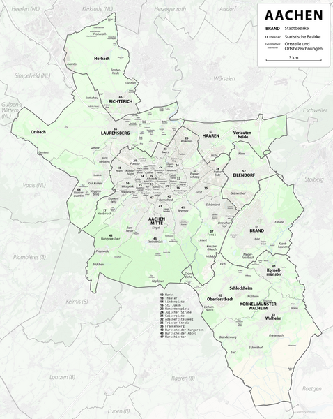
File:Karte Aachen Stadtbezirke.png

Dimension de iste previsualisation: 478 × 600 pixels.Altere resolutiones: 191 × 240 pixels | 382 × 480 pixels | 612 × 768 pixels | 816 × 1 024 pixels | 1 632 × 2 048 pixels | 3 660 × 4 594 pixels.
File original (3 660 × 4 594 pixels, dimension del file: 14,74 MB, typo MIME: image/png)
Summario
| Description |
|
| Data | see file history |
| Origine |
Own work using:
|
| Autor | Maximilian Dörrbecker |
| Permission (Reuso de iste file) |
All OpenStreetMap data and maps are Creative Commons "CC-BY-SA 2.0" licensed Iste file es disponibile sub le licentia Creative Commons Attribution-CompartiSimile 2.0 Generic.
|
Historia del file
Clicca sur un data/hora pro vider le file como appareva a ille tempore.
| Data/Hora | Miniatura | Dimensiones | Usator | Commento | |
|---|---|---|---|---|---|
| actual | 17:40, 30 maio 2023 | | 3 660 × 4 594 (14,74 MB) | Grunpfnul | Tippfehler: Statische zu Statistische |
| 21:46, 30 maio 2019 |  | 3 660 × 4 594 (14,2 MB) | Chumwa | ||
| 17:49, 25 maio 2019 |  | 3 660 × 4 594 (14,12 MB) | Chumwa | ||
| 20:05, 24 maio 2019 |  | 3 660 × 4 594 (13,49 MB) | Chumwa | ||
| 06:06, 24 maio 2019 |  | 3 660 × 4 594 (13,44 MB) | Chumwa | ||
| 23:04, 23 maio 2019 |  | 3 660 × 4 594 (13,4 MB) | Chumwa | ||
| 22:16, 23 maio 2019 |  | 3 660 × 4 594 (13,31 MB) | Chumwa | ||
| 19:33, 23 maio 2019 |  | 3 563 × 5 115 (16,28 MB) | Chumwa | == {{int:filedesc}} == {{Information |Description= *{{de|Entwurf für eine Karte der Stadtbezirke von Aachen}} |Author=Maximilian Dörrbecker |Source={{own using}} * OpenStreetMap data for the background * Stadtbeirke von Aachen by {{U|Furfur}} |Date=see file history |Permission=All OpenStreetMap data and maps are Creative Commons "CC-BY-SA 2.0" licensed{{cc-by-sa-2.0}} |other_versions= }} Category:Maps of Aachen [[Category:Maxi... |
Uso de iste file
Le sequente pagina usa iste file:
Uso global de iste file
Le altere wikis sequente usa iste imagine:
- Uso in af.wikipedia.org
- Uso in als.wikipedia.org
- Uso in am.wikipedia.org
- Uso in ast.wikipedia.org
- Uso in azb.wikipedia.org
- Uso in az.wikipedia.org
- Uso in ban.wikipedia.org
- Uso in be-tarask.wikipedia.org
- Uso in be.wikipedia.org
- Uso in bg.wikipedia.org
- Uso in br.wikipedia.org
- Uso in ca.wikipedia.org
- Uso in ceb.wikipedia.org
- Uso in co.wikipedia.org
- Uso in csb.wikipedia.org
- Uso in cs.wikipedia.org
- Uso in cy.wikipedia.org
- Uso in da.wikipedia.org
- Uso in de.wikipedia.org
- Uso in el.wikipedia.org
- Uso in en.wikipedia.org
- Uso in eo.wikipedia.org
- Uso in es.wikipedia.org
- Uso in et.wikipedia.org
- Uso in eu.wikipedia.org
- Uso in fa.wikipedia.org
- Uso in fi.wikipedia.org
- Uso in frr.wikipedia.org
- Uso in fr.wikipedia.org
- Uso in fy.wikipedia.org
- Uso in gd.wikipedia.org
- Uso in he.wikipedia.org
- Uso in hi.wikipedia.org
- Uso in hr.wikipedia.org
- Uso in hsb.wikipedia.org
- Uso in hu.wikipedia.org
- Uso in hy.wikipedia.org
- Uso in id.wikipedia.org
- Uso in ie.wikipedia.org
- Uso in io.wikipedia.org
- Uso in is.wikipedia.org
- Uso in ja.wikipedia.org
- Uso in kk.wikipedia.org
- Uso in ko.wikipedia.org
Vider altere usos global de iste file.