File:Map of the Faroe Islands en.svg

Dimension de iste previsualisation PNG de iste file SVG: 457 × 600 pixels. Altere resolutiones: 183 × 240 pixels | 366 × 480 pixels | 585 × 768 pixels | 780 × 1 024 pixels | 1 561 × 2 048 pixels | 1 683 × 2 208 pixels.
File original (File SVG, dimensiones nominal: 1 683 × 2 208 pixels, grandor del file: 763 KB)
Summario
| Description |
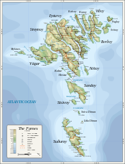
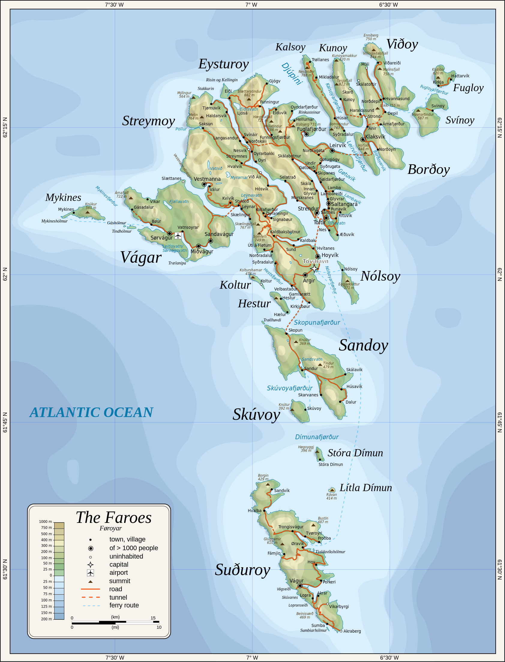
English: Topographic map of the Faroe Islands.
Suomi: Färsaarten topografinen kartta.
Coastline, roads, place names, and summits based partly on File:Faroe map with villages, streets, straits, firths, ferry harbours and major moutains.png. Topography based on public domain GLOBE data from NOAA (http://www.ngdc.noaa.gov/mgg/topo/gltiles.html). Relief shading is an embedded PNG raster, derived from ETOPO2 data. Bathymetry from NGDC ETOPO2 (low resolution raster with a "blur" property). |
| Data | 2009-01-28, 2024-02-11 |
| Origine | Obra proprie |
| Autor | Oona Räisänen |
| Altere versiones |
Derivative works of this file: |
| SVG genesis |
Licentia
Oona Räisänen (Mysid), titular del derecto de autor sur iste obra, declara de publicar lo sub le sequente licentias:
Iste file es disponibile sub le licentia Creative Commons Attribution-CompartiSimile 3.0 Non-localisate.
Attribution: Oona Räisänen (Mysid)
- Tu es libere:
- de condivider – de copiar, distribuer e transmitter le obra
- de remixar – de adaptar le obra
- Sub le sequente conditiones:
- attribution – Tu debe dar information appropriate sur le autor, fornir un ligamine al licentia, e indicar si modificationes ha essite apportate. Tu pote facer lo de qualcunque maniera rationabile, ma non in alcun modo que suggere que le licentiator approba te o tu uso del obra.
- condivider equalmente – Si tu altera, transforma o disveloppa le material, tu debe distribuer tu contributiones sub un licentia identic o compatibile con le original.

|
Le permission es concedite de copiar, distribuer e/o modificar iste documento sub le conditiones del Licentia GNU pro Documentation Libere, Version 1.2 o omne version plus recente publicate per le Fundation pro Software Libere; sin Sectiones Invariabile, sin Textos de Copertura Frontal e sin Textos de Copertura Posterior. Un copia del licentia es includite in le section titulate Licentia GNU pro Documentation Libere. |
Tu pote seliger le licentia de tu preferentia.
Historia del file
Clicca sur un data/hora pro vider le file como appareva a ille tempore.
| Data/Hora | Miniatura | Dimensiones | Usator | Commento | |
|---|---|---|---|---|---|
| actual | 20:53, 11 februario 2024 | | 1 683 × 2 208 (763 KB) | Mysid | 'Multiply' blend mode didn't work - trying with alpha channel. |
| 20:34, 11 februario 2024 |  | 1 683 × 2 208 (733 KB) | Mysid | Added new 2023 tunnel, new names of some villages, fixed mistakes and svg errors, details | |
| 09:18, 19 julio 2010 |  | 1 683 × 2 208 (539 KB) | Mysid | oops, legend missing | |
| 09:16, 19 julio 2010 |  | 1 683 × 2 208 (539 KB) | Mysid | better choices for fonts | |
| 19:22, 28 januario 2009 |  | 1 683 × 2 208 (694 KB) | Mysid | remove ext. images | |
| 19:21, 28 januario 2009 |  | 1 683 × 2 208 (694 KB) | Mysid | embed all rasters | |
| 18:52, 28 januario 2009 |  | 1 683 × 2 208 (653 KB) | Mysid | {{Information |Description={{en|1=Topographic map of the Faroe Islands.}} |Source=Own work by uploader |Author=Mysid |Date=2009-01-28 |Permission= |other_versions= }} <!--{{ImageUpload|full}}--> Category:Maps of the Faroe Islands |
Uso de iste file
Le sequente pagina usa iste file:
Uso global de iste file
Le altere wikis sequente usa iste imagine:
- Uso in bg.wikipedia.org
- Uso in bn.wikipedia.org
- Uso in dsb.wikipedia.org
- Uso in el.wikipedia.org
- Uso in en.wikipedia.org
- Uso in es.wikipedia.org
- Uso in fa.wikipedia.org
- Uso in fi.wikipedia.org
- Uso in fo.wikipedia.org
- Uso in frr.wikipedia.org
- Uso in fr.wikipedia.org
- Uso in ga.wikipedia.org
- Uso in hu.wikipedia.org
- Uso in is.wikipedia.org
- Uso in it.wikipedia.org
- Uso in ka.wikipedia.org
- Uso in kk.wikipedia.org
- Uso in ko.wikipedia.org
- Uso in lb.wikipedia.org
- Uso in lez.wikipedia.org
- Uso in mi.wikipedia.org
- Uso in mk.wikipedia.org
- Uso in nl.wikipedia.org
- Uso in ru.wikipedia.org
- Uso in scn.wikipedia.org
- Uso in sco.wikipedia.org
- Uso in sc.wikipedia.org
- Uso in sr.wikipedia.org
- Uso in sv.wikipedia.org
Vider altere usos global de iste file.