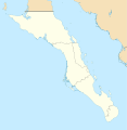
File:Mexico Baja California Sur location map.svg

Dimension de iste previsualisation PNG de iste file SVG: 586 × 599 pixels. Altere resolutiones: 235 × 240 pixels | 469 × 480 pixels | 751 × 768 pixels | 1 001 × 1 024 pixels | 2 002 × 2 048 pixels | 923 × 944 pixels.
File original (File SVG, dimensiones nominal: 923 × 944 pixels, grandor del file: 374 KB)
Historia del file
Clicca sur un data/hora pro vider le file como appareva a ille tempore.
| Data/Hora | Miniatura | Dimensiones | Usator | Commento | |
|---|---|---|---|---|---|
| actual | 19:32, 7 augusto 2011 |  | 923 × 944 (374 KB) | Addicted04 | color |
| 19:28, 7 augusto 2011 |  | 923 × 944 (374 KB) | Battroid | {{ValidSVG}} {{Information |Description={{en|1=Own work as from the map of municipalities of INEGI and costs taken from OpenStreetMap.org (under Creative Commons Attribution-Share Alike 2.0 Generic Licence). Limits of map: * West : 115.50' W * Est : 109. | |
| 21:36, 27 octobre 2009 |  | 923 × 944 (374 KB) | Spischot | Fix: Isla de Cedros to Baja California | |
| 21:12, 27 octobre 2009 |  | 923 × 944 (363 KB) | Spischot | {{Information |Description={{en|1=Own work as from the map of municipalities of INEGI and costs taken from OpenStreetMap.org (under Creative Commons Attribution-Share Alike 2.0 Generic Licence). Limits of map: * West : 115º 5' W * Est : 109º W * Nort |
Uso de iste file
Le sequente pagina usa iste file:
Uso global de iste file
Le altere wikis sequente usa iste imagine:
- Uso in ar.wikipedia.org
- Uso in ba.wikipedia.org
- Uso in bg.wikipedia.org
- Uso in ceb.wikipedia.org
- Uso in ce.wikipedia.org
- Uso in cs.wikipedia.org
- Uso in de.wikipedia.org
- La Paz (Baja California Sur)
- Loreto (Baja California Sur)
- Guerrero Negro
- Mulegé
- San Ignacio (Baja California Sur)
- Isla Espíritu Santo
- Isla Santa Catalina (Mexiko)
- Santa Rosalía
- Benutzer:Spischot/Bilder
- Aguajito
- Wikipedia:Kartenwerkstatt/Positionskarten/Nordamerika
- Cabo San Lucas
- San Bruno (Baja California Sur)
- Todos Santos (Mexiko)
- Isla Santa Margarita
- Vorlage:Positionskarte Mexiko Baja California Sur
- Tortuga (Mexiko)
- Isla Natividad
- Isla Carmen
- Isla Monserrat
- Isla Coronados
- Isla San Marcos
- Isla Santa Cruz (Mexiko)
- Isla San Diego
- Isla Danzante
- Isla San Francisco
- Bahía Magdalena
- San José del Cabo
- Nationalpark Cabo Pulmo
- Estadio Guaycura
- Ciudad Constitución (Mexiko)
- Uso in en.wikipedia.org
Vider altere usos global de iste file.
