File:Morocco relief location map.jpg

Dimension de iste previsualisation: 737 × 600 pixels.Altere resolutiones: 295 × 240 pixels | 590 × 480 pixels | 944 × 768 pixels | 1 223 × 995 pixels.
File original (1 223 × 995 pixels, dimension del file: 265 KB, typo MIME: image/jpeg)
Summario
| Description |
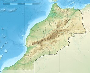
English: Blank physical map of Morocco, for geo-location purposes.
Français : Carte physique vierge du Maroc, destinée à la géolocalisation. Scale: 1:4,000,000 (precision: 1,000 m)
Geographic limits of the map:
|
||
| Data | 2009-11, updated 2017-02 | ||
| Origine |
Obra proprie
|
||
| Autor | Eric Gaba (Sting - fr:Sting) | ||
| Permission (Reuso de iste file) |
|
||
| Altere versiones |
|

| Camera location | | View this and other nearby images on: OpenStreetMap |
|---|
Licentia
Io, titular del derecto de autor sur iste obra, declara de publicar lo sub le sequente licentias:
Iste file es disponibile sub le licentia Creative Commons Attribution-CompartiSimile 3.0 Non-localisate.
- Tu es libere:
- de condivider – de copiar, distribuer e transmitter le obra
- de remixar – de adaptar le obra
- Sub le sequente conditiones:
- attribution – Tu debe dar information appropriate sur le autor, fornir un ligamine al licentia, e indicar si modificationes ha essite apportate. Tu pote facer lo de qualcunque maniera rationabile, ma non in alcun modo que suggere que le licentiator approba te o tu uso del obra.
- condivider equalmente – Si tu altera, transforma o disveloppa le material, tu debe distribuer tu contributiones sub un licentia identic o compatibile con le original.

|
Le permission es concedite de copiar, distribuer e/o modificar iste documento sub le conditiones del Licentia GNU pro Documentation Libere, Version 1.2 o omne version plus recente publicate per le Fundation pro Software Libere; sin Sectiones Invariabile, sin Textos de Copertura Frontal e sin Textos de Copertura Posterior. Un copia del licentia es includite in le section titulate Licentia GNU pro Documentation Libere. |
Tu pote seliger le licentia de tu preferentia.
Historia del file
Clicca sur un data/hora pro vider le file como appareva a ille tempore.
| Data/Hora | Miniatura | Dimensiones | Usator | Commento | |
|---|---|---|---|---|---|
| actual | 20:55, 10 februario 2017 | | 1 223 × 995 (265 KB) | Sting | Updated regions borders as since 2015 |
| 13:11, 19 julio 2010 |  | 1 223 × 995 (234 KB) | Sting | Color profile | |
| 20:31, 21 novembre 2009 |  | 1 223 × 995 (240 KB) | Sting | Putting back the southern dotted boundary (regarding Western Sahara's location map) | |
| 01:23, 21 novembre 2009 |  | 1 223 × 995 (239 KB) | Sting | Drawback for one "correction" | |
| 01:10, 21 novembre 2009 |  | 1 223 × 995 (240 KB) | Sting | Several little corrections | |
| 00:09, 21 novembre 2009 |  | 1 223 × 995 (241 KB) | Sting | == {{int:filedesc}} == {{Location|31|46|30|N|7|04|30|W|scale:5000000}} <br/> {{Information |Description={{en|Blank physical map of Morocco, for geo-location purposes.}} {{fr|Carte physique vierge du Maroc, destinée à la gé |
Uso de iste file
Le sequente pagina usa iste file:
Uso global de iste file
Le altere wikis sequente usa iste imagine:
- Uso in af.wikipedia.org
- Uso in ar.wikipedia.org
- Uso in ast.wikipedia.org
- Uso in azb.wikipedia.org
- Uso in az.wikipedia.org
- Uso in ba.wikipedia.org
- Uso in be.wikipedia.org
- Uso in bg.wikipedia.org
Vider altere usos global de iste file.