File:North America second level political division 2.svg

File original(File SVG, dimensiones nominal: 512 × 596 pixels, grandor del file: 132 KB)

Iste file proveni de Wikimedia Commons e pote esser usate per altere projectos. Le description de su pagina de description ibi es monstrate in basso.

Summario

Description
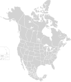
English: Map of North America and its second-level political divisions. Canadian provinces, US and Mexican states. Canada, Mexico, United States.

Non-contiguous parts of a states/provinces are "grouped" together with the main area of the state/provinces, so any state/provinces can be coloured in completion with one click anywhere on the state/provinces's area.

Also, all states/provinces have a "id" attached to them, making them easy to find. Select "find" and then enter in the state/provinces's ISO 3166-2 code in the "id" field to find it. The codes can be found here (Canada), here (USA) and here (Mexico).
Data
Origine

Canada and US map: BlankMap-USA-states-Canada-provinces, HI closer.svg by Lokal_Profil.
Mexico map: Mexico template.svg by Mario Fuente Cid
Combined by Alex Covarrubias.

 
The SVG code is valid.
 
This vector image was created with Inkscape, and then manually edited
.
 
W3C-validity not checked.
Autor Alex Covarrubias
Permission
(Reuso de iste file)
w:ia:Creative Commons
attribution condivider equalmente
Iste file es disponibile sub le licentia Creative Commons Attribution-CompartiSimile 2.5 Generic.
Tu es libere:
  • de condivider – de copiar, distribuer e transmitter le obra
  • de remixar – de adaptar le obra
Sub le sequente conditiones:
  • attribution – Tu debe dar information appropriate sur le autor, fornir un ligamine al licentia, e indicar si modificationes ha essite apportate. Tu pote facer lo de qualcunque maniera rationabile, ma non in alcun modo que suggere que le licentiator approba te o tu uso del obra.
  • condivider equalmente – Si tu altera, transforma o disveloppa le material, tu debe distribuer tu contributiones sub un licentia identic o compatibile con le original.
Altere versiones

Derivative works of this file:

Legendas

Adde un explanation de un linea de lo que iste file representa

Objectos representate in iste file

representa

copyrighted anglese

inception anglese

7 octobre 2007

Historia del file

Clicca sur un data/hora pro vider le file como appareva a ille tempore.

Data/HoraMiniaturaDimensionesUsatorCommento
actual01:51, 23 novembre 2020Miniatura pro le version de 01:51, 23 novembre 2020512 × 596 (132 KB)Ponderosapine210Added the prominent islands of Manitoulin (Ontario) and Isle Royale (Michigan) to the Great Lakes.
23:07, 1 junio 2019Miniatura pro le version de 23:07, 1 junio 2019512 × 596 (130 KB)Fluffy89502added territories, made DC visible, adjusted mexican borders
12:23, 4 april 2014Miniatura pro le version de 12:23, 4 april 20141 712 × 1 992 (270 KB)Lommesmade the borders between the mexican subdivisions the same size as their canadian / us counterparts.
23:23, 8 decembre 2007Miniatura pro le version de 23:23, 8 decembre 20071 712 × 1 992 (327 KB)Lokal ProfilCode cleanup
07:55, 7 octobre 2007Miniatura pro le version de 07:55, 7 octobre 20071 712 × 1 992 (342 KB)AlexCovarrubias== Summary == {{Information |Description=Map of North America and its second-level political divisions. Canadian provinces, US and Mexican states. Canada, Mexico, United States. |Source=Canada and US map by Alan Rockefeller. Mexico map by Alex Covarrubias

Il non ha paginas que usa iste file.

Uso global de iste file

Metadatos