File original (File SVG, dimensiones nominal: 712 × 807 pixels, grandor del file: 652 KB)

Iste file proveni de Wikimedia Commons e pote esser usate per altere projectos. Le description de su pagina de description ibi es monstrate in basso.

Summario

Description
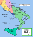
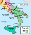
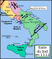
English: This is a political map of southern Italy in 1112 AD, the date when Roger II of Sicily reached his age of majority, also showing the border of the Kingdom of Sicily in 1154, on his death.

"The rarity of surviving records makes it impossible to draw a map of comital [counts'] responsibiities in southern Italy at the beginning of the twelth century." Matthew, p. 23.

As noted by Matthew, the political situation in southern Italy is much more complex than this map shows. There were numerous counts and semi-independent cities throughout the region. Moreover, the near-constant rebellions and conquests continually re-arranged the map.
Data
Origine Obra proprie
Autor MapMaster
Altere versiones

[modificar]

References

  • Bjorklund, Oddvar; Holmboe, Haakon; Rohr, Anders (1970) Historical Atlas of the World, Barnes & Noble, NY, SBN: 389-00253-4.
  • Houben, Hubert (translated by Graham A. Loud and Diane Milburn), (2002) Roger II of Sicily: Ruler between East and West, Cambridge University Press.
  • Konstam, Angus (2000) Atlas of Medieval Europe, Checkmark Books, New York.
  • Matthew, Donald (1992) The Norman Kingdom of Sicily Cambridge Medieval Textbooks.

Licentia

Io, titular del derecto de autor sur iste obra, declara de publicar lo sub le sequente licentia:
GNU head Le permission es concedite de copiar, distribuer e/o modificar iste documento sub le conditiones del Licentia GNU pro Documentation Libere, Version 1.2 o omne version plus recente publicate per le Fundation pro Software Libere; sin Sectiones Invariabile, sin Textos de Copertura Frontal e sin Textos de Copertura Posterior. Un copia del licentia es includite in le section titulate Licentia GNU pro Documentation Libere.
w:ia:Creative Commons
attribution condivider equalmente
Iste file es disponibile sub le licentia Creative Commons Attribution-CompartiSimile 3.0 Non localisate.
Tu es libere:
  • de condivider – de copiar, distribuer e transmitter le obra
  • de remixar – de adaptar le obra
Sub le sequente conditiones:
  • attribution – Tu debe dar information appropriate sur le autor, fornir un ligamine al licentia, e indicar si modificationes ha essite apportate. Tu pote facer lo de qualcunque maniera rationabile, ma non in alcun modo que suggere que le licentiator approba te o tu uso del obra.
  • condivider equalmente – Si tu altera, transforma o disveloppa le material, tu debe distribuer tu contributiones sub un licentia identic o compatibile con le original.
Iste etiquetta de licentia esseva addite a iste file como parte del actualisation del licentia GFDL.

Legendas

Adde un explanation de un linea de lo que iste file representa

Objectos representate in iste file

representa

Alcun valor sin elemento Wikidata

copyrighted anglese

inception anglese

16 decembre 2006

Historia del file

Clicca sur un data/hora pro vider le file como appareva a ille tempore.

Data/HoraMiniaturaDimensionesUsatorCommento
actual17:29, 9 januario 2008Miniatura pro le version de 17:29, 9 januario 2008712 × 807 (652 KB)Salli~commonswiki
21:12, 16 april 2007Miniatura pro le version de 21:12, 16 april 2007712 × 807 (739 KB)MapMasterSlightly modified version
16:32, 20 decembre 2006Miniatura pro le version de 16:32, 20 decembre 2006712 × 807 (739 KB)MapMasterFixed typo, added Taranto
14:15, 16 decembre 2006Miniatura pro le version de 14:15, 16 decembre 2006712 × 807 (729 KB)MapMasterA political map of southern Italy in 1112 AD/CE, the date when Roger II of Sicily reached his age of majority.

Le sequente pagina usa iste file:

Uso global de iste file

Le altere wikis sequente usa iste imagine:

Vider altere usos global de iste file.