File:Tarrant County Texas Incorporated Areas Arlington highlighted.svg

Dimension de iste previsualisation PNG de iste file SVG: 800 × 436 pixels. Altere resolutiones: 320 × 175 pixels | 640 × 349 pixels | 1 024 × 559 pixels | 1 280 × 698 pixels | 2 560 × 1 396 pixels.
File original (File SVG, dimensiones nominal: 1 100 × 600 pixels, grandor del file: 235 KB)
Summario
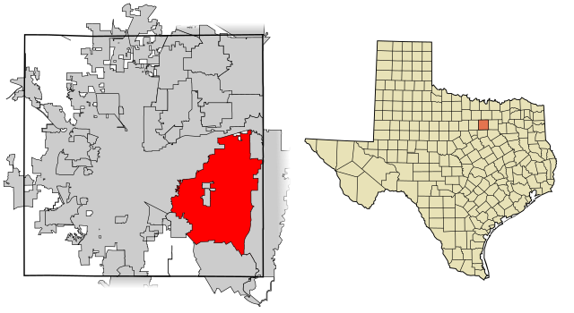
| Description | This map shows the incorporated areas in Tarrant County, Texas. Arlington is highlighted in red. I created it in Inkscape using data from the following links: North Central Texas Council of Governments Maps Website, City of Fort Worth Interactive Zoning Map |
| Data | |
| Origine | My own work, based on government information. Though I strove to be as accurate in the detail as possible, the information shown is not guaranteed to be completely accurate. |
| Autor | Ixnayonthetimmay |
| Permission (Reuso de iste file) |
Public Domain |
| Altere versiones | See Category:Maps of Tarrant County, Texas for other versions of this image. |
Licentia
| Io, titular del derecto de autor sur iste obra, libera iste obra al dominio public. Isto vale in tote le mundo. In alcun paises isto pote non esser legalmente possibile. In tal caso: Io concede a omnes le derecto de usar iste obra pro non importa qual fin, sin conditiones, a minus que tal conditiones sia requirite per lege. |
Historia del file
Clicca sur un data/hora pro vider le file como appareva a ille tempore.
| Data/Hora | Miniatura | Dimensiones | Usator | Commento | |
|---|---|---|---|---|---|
| actual | 10:37, 4 septembre 2007 | | 1 100 × 600 (235 KB) | Ixnayonthetimmay | == Summary == {{Information |Description=This map shows the incorporated areas in Tarrant County, Texas. Arlington is highlighted in red. I created it in [[en:Inksca |
Uso de iste file
Le sequente pagina usa iste file:
Uso global de iste file
Le altere wikis sequente usa iste imagine:
- Uso in af.wikipedia.org
- Uso in ang.wikipedia.org
- Uso in ar.wikipedia.org
- Uso in arz.wikipedia.org
- Uso in bn.wikipedia.org
- Uso in br.wikipedia.org
- Uso in ca.wikipedia.org
- Uso in ceb.wikipedia.org
- Uso in cs.wikipedia.org
- Uso in de.wikipedia.org
- Uso in el.wikipedia.org
- Uso in en.wikipedia.org
- Uso in eo.wikipedia.org
- Uso in es.wikipedia.org
- Uso in et.wikipedia.org
- Uso in eu.wikipedia.org
- Uso in fa.wikipedia.org
- Uso in fi.wikipedia.org
- Uso in ga.wikipedia.org
- Uso in gl.wikipedia.org
- Uso in hi.wikipedia.org
- Uso in hr.wikipedia.org
- Uso in ht.wikipedia.org
- Uso in hu.wikipedia.org
- Uso in incubator.wikimedia.org
- Uso in io.wikipedia.org
- Uso in it.wikipedia.org
- Uso in ja.wikipedia.org
- Uso in kw.wikipedia.org
- Uso in ml.wikipedia.org
- Uso in ms.wikipedia.org
- Uso in nl.wikipedia.org
- Uso in pnb.wikipedia.org
- Uso in pt.wikipedia.org
- Uso in ro.wikipedia.org
- Uso in sc.wikipedia.org
- Uso in simple.wikipedia.org
- Uso in sk.wikipedia.org
- Uso in sl.wikipedia.org
- Uso in sr.wikipedia.org
- Uso in sv.wikipedia.org
- Uso in sw.wikipedia.org
- Uso in th.wikipedia.org
- Uso in tr.wikipedia.org
- Uso in tt.wikipedia.org
- Uso in ur.wikipedia.org
- Uso in vo.wikipedia.org
- Uso in www.wikidata.org
- Uso in yo.wikipedia.org
- Uso in zh.wikipedia.org