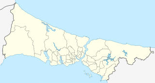
File:Turkey Istanbul location map.svg

File original (File SVG, dimensiones nominal: 1 568 × 845 pixels, grandor del file: 424 KB)
Summario
| Description |
Geographische Begrenzung der Karte:
Geographic limits of the map:
|
| Data | |
| Origine |
Own work using: File:Istanbul location districts.svg by |
| Autor | NordNordWest |

|
This map has been made or improved in the German Kartenwerkstatt (Map Lab). You can propose maps to improve as well.
|
Licentia
Usage of this file with:

explanatory notes: Legally binding is only the full legalcode. For a free usage I recommend to respect the following licence conditions:
1. Provide my name as given above: NordNordWest,
2. a copy of, or the URI for, the applicable license: https://creativecommons.org/licenses/by-sa/3.0/de/legalcode,
3. the title of the work,
4. in the case of an adaptation, a credit identifying the use of the work in the adaptation.
This license and the rights granted hereunder will terminate automatically upon any breach by you of the terms of this license. Any of the above conditions can be waived if you get permission from the copyright holder. If you have questions or wish differing conditions, please contact me through nnwest or my discussion page ![]() t-online.de
t-online.de
- Tu es libere:
- de condivider – de copiar, distribuer e transmitter le obra
- de remixar – de adaptar le obra
- Sub le sequente conditiones:
- attribution – Tu debe dar information appropriate sur le autor, fornir un ligamine al licentia, e indicar si modificationes ha essite apportate. Tu pote facer lo de qualcunque maniera rationabile, ma non in alcun modo que suggere que le licentiator approba te o tu uso del obra.
- condivider equalmente – Si tu altera, transforma o disveloppa le material, tu debe distribuer tu contributiones sub un licentia identic o compatibile con le original.

Historia del file
Clicca sur un data/hora pro vider le file como appareva a ille tempore.
| Data/Hora | Miniatura | Dimensiones | Usator | Commento | |
|---|---|---|---|---|---|
| actual | 17:26, 6 april 2018 | | 1 568 × 845 (424 KB) | NordNordWest | upd |
| 11:37, 16 augusto 2014 |  | 1 568 × 845 (465 KB) | NordNordWest | == {{int:filedesc}} == {{Information |Description= {{de|Positionskarte der Provinz Istanbul, Türkei}} Geographische Begrenzung der Karte: * N: 41.619888° N * S: 40.796666° N * W: 27.941666° O * O: 29.97388... |
Uso de iste file
Le sequente pagina usa iste file:
Uso global de iste file
Le altere wikis sequente usa iste imagine:
- Uso in ar.wikipedia.org
- Uso in azb.wikipedia.org
- Uso in az.wikipedia.org
- Ayasofiya
- Topqapı sarayı
- Əyyub Sultan məscidi
- Sultan Əhməd məscidi
- Zal Mahmud paşa məscidi
- Ulduz sarayı
- Laləli məscidi
- Yavuz Sultan Səlim külliyəsi
- Bəyazid məscidi
- İbrahim Paşa Sarayı
- Ulduz Saat Qülləsi
- Abdi İpəkçi sui-qəsdi
- Rumeli Hasarı
- Yeni məscid (İstanbul)
- Mehrimah Sultan məscidi (Üsküdar)
- Haseki hamamı
- Ağa hamamı
- Dolmabağça saat qülləsi
- Topxana saat qülləsi
- Nuruosmaniyə məscidi
- Atatürk körpüsü
- Yeddiqüllə zindanları
- İstanbul Əşkinazi sinaqoqu
- Küçüksu sarayı
- Hidiv qəsri
- Səbətçilər sarayı
- İhlamur sarayı
- Florya Atatürk Dəniz Köşkü
- Çırağan sarayı
- Şablon:Yer xəritəsi Türkiyə İstanbul
- Fateh məscidi (İstanbul)
- Kiçik Vlaxerna sarayı
- İstanbul Hava Limanı
- Lütfü Kırdar Konqres və Sərgi Sarayı (İstanbul)
- Ulduz Həmidiyyə məscidi
- Böyük İstanbul avtovağzalı
- Türkiyə Super Liqası 2021/2022
- Türkiyə Super Liqası 2020/2021
- Türkiyə Super Liqası 2019/2020
- Türkiyə Super Liqası 2018/2019
- Uso in bn.wikipedia.org
Vider altere usos global de iste file.