File:USA Puerto Rico location map.svg

Dimension de iste previsualisation PNG de iste file SVG: 800 × 450 pixels. Altere resolutiones: 320 × 180 pixels | 640 × 360 pixels | 1 024 × 576 pixels | 1 280 × 720 pixels | 2 560 × 1 440 pixels | 1 058 × 595 pixels.
File original (File SVG, dimensiones nominal: 1 058 × 595 pixels, grandor del file: 114 KB)
Summario
| Description |
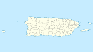
Quadratische Plattkarte, N-S-Streckung 105 %. Geographische Begrenzung der Karte:
Equirectangular projection, N/S stretching 105 %. Geographic limits of the map:
|
| Data | |
| Origine | own work, using U.S. Geological Survey (USGS) data |
| Autor | NordNordWest |
| Altere versiones |
|


|
This map has been made or improved in the German Kartenwerkstatt (Map Lab). You can propose maps to improve as well.
|
Licentia
Io, titular del derecto de autor sur iste obra, declara de publicar lo sub le sequente licentia:
Iste file es disponibile sub le licentia Creative Commons Attribution-CompartiSimile 3.0 Non-localisate.
- Tu es libere:
- de condivider – de copiar, distribuer e transmitter le obra
- de remixar – de adaptar le obra
- Sub le sequente conditiones:
- attribution – Tu debe dar information appropriate sur le autor, fornir un ligamine al licentia, e indicar si modificationes ha essite apportate. Tu pote facer lo de qualcunque maniera rationabile, ma non in alcun modo que suggere que le licentiator approba te o tu uso del obra.
- condivider equalmente – Si tu altera, transforma o disveloppa le material, tu debe distribuer tu contributiones sub un licentia identic o compatibile con le original.
Historia del file
Clicca sur un data/hora pro vider le file como appareva a ille tempore.
| Data/Hora | Miniatura | Dimensiones | Usator | Commento | |
|---|---|---|---|---|---|
| actual | 07:13, 19 junio 2009 | | 1 058 × 595 (114 KB) | NordNordWest | {{Information |Description= {{de|Positionskarte von Puerto Rico, USA}} Quadratische Plattkarte, N-S-Streckung 105 %. Geographische Begrenzung der Karte: * N: 19.0° N * S: 17.5° N * W: 68.0° W * O: 65.2° W {{en|Location |
Uso de iste file
Le sequente pagina usa iste file:
Uso global de iste file
Le altere wikis sequente usa iste imagine:
- Uso in af.wikipedia.org
- Uso in an.wikipedia.org
- Uso in ar.wikipedia.org
- Uso in ast.wikipedia.org
- Uso in azb.wikipedia.org
- Uso in az.wikipedia.org
- Uso in be.wikipedia.org
- Uso in bg.wikipedia.org
- Uso in ca.wikipedia.org
- Uso in ceb.wikipedia.org
Vider altere usos global de iste file.