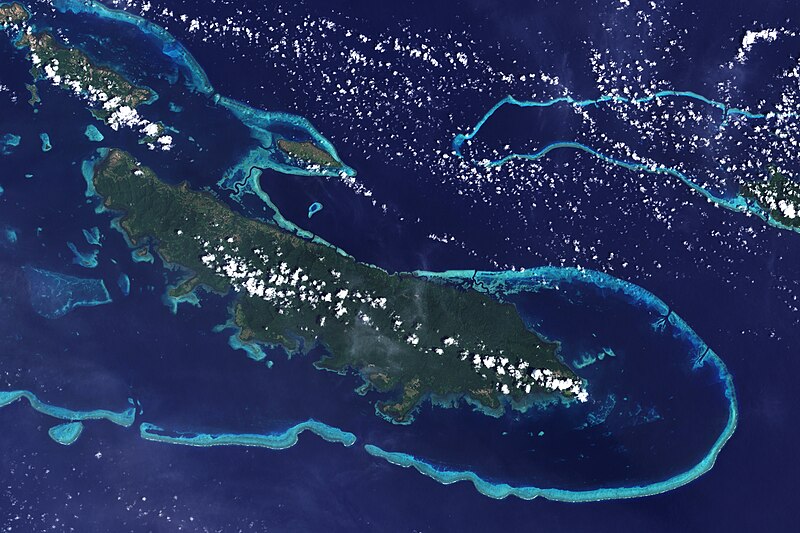
File:Vanatinai, Louisiade Archipelago.jpg

Dimension de iste previsualisation: 800 × 533 pixels.Altere resolutiones: 320 × 213 pixels | 640 × 427 pixels | 1 024 × 683 pixels | 1 280 × 853 pixels | 2 560 × 1 707 pixels | 3 600 × 2 400 pixels.
File original (3 600 × 2 400 pixels, dimension del file: 2,93 MB, typo MIME: image/jpeg)
Historia del file
Clicca sur un data/hora pro vider le file como appareva a ille tempore.
| Data/Hora | Miniatura | Dimensiones | Usator | Commento | |
|---|---|---|---|---|---|
| actual | 12:34, 26 april 2009 |  | 3 600 × 2 400 (2,93 MB) | Originalwana | {{Information |Description={{en|1=The lower corner of the scene shows part of the northwestern coast of the largest island in the archipelago, Vanatinai. Most of the island is densely covered in lowland rainforest, but clearing for agricultural land is wi |
Uso de iste file
Le sequente pagina usa iste file:
Uso global de iste file
Le altere wikis sequente usa iste imagine:
- Uso in ar.wikipedia.org
- Uso in arz.wikipedia.org
- Uso in ca.wikipedia.org
- Uso in ceb.wikipedia.org
- Uso in cy.wikipedia.org
- Uso in de.wikipedia.org
- Uso in en.wikipedia.org
- Uso in eo.wikipedia.org
- Uso in es.wikipedia.org
- Uso in et.wikipedia.org
- Uso in fa.wikipedia.org
- Uso in fi.wikipedia.org
- Uso in fr.wikipedia.org
- Uso in he.wikipedia.org
- Uso in id.wikipedia.org
- Uso in it.wikipedia.org
- Uso in kw.wikipedia.org
- Uso in lv.wikipedia.org
- Uso in nl.wikipedia.org
- Uso in pl.wikipedia.org
- Uso in simple.wikipedia.org
- Uso in uk.wikipedia.org
- Uso in vi.wikipedia.org
- Uso in vls.wikipedia.org
- Uso in www.wikidata.org
- Uso in zh.wikipedia.org

